
Precision Agriculture
Satellite Land Leveling System: How Does It Work?
How Does a Satellite Land Leveling System Work?
Satellite land leveling is one of the modern methods used to level and grade agricultural land. This technology uses satellite positioning systems to provide accurate information about the location and elevation of agricultural machinery and the land surface.
Unlike traditional leveling methods, satellite-based land leveling allows operators to monitor the position and elevation of the leveling equipment in real time. By comparing the actual elevation of the land with the target elevation, the system helps determine where soil needs to be removed or added.
To achieve an accurate and uniform surface, satellite land leveling involves several important stages. In this article, we explain how a satellite land leveling system works and examine the main steps involved in the process.
How Does a Satellite Land Leveling System Work?
The satellite land leveling process consists of several main stages, starting with preparing the land and installing the positioning equipment and continuing through accurate positioning, equipment setup, leveling operations, final inspection, and recording the results.
Preparing the Land
Before starting satellite land leveling, the condition of the land should be carefully evaluated. High and low points, slopes, depressions, and other irregularities across the field need to be identified.
This initial assessment provides a better understanding of the existing land surface and helps determine the appropriate plan for moving soil and correcting elevation differences.
The more accurate the initial information is, the easier it becomes to perform the leveling operation efficiently and accurately.
Selecting the Location of the Satellite Reference Antenna
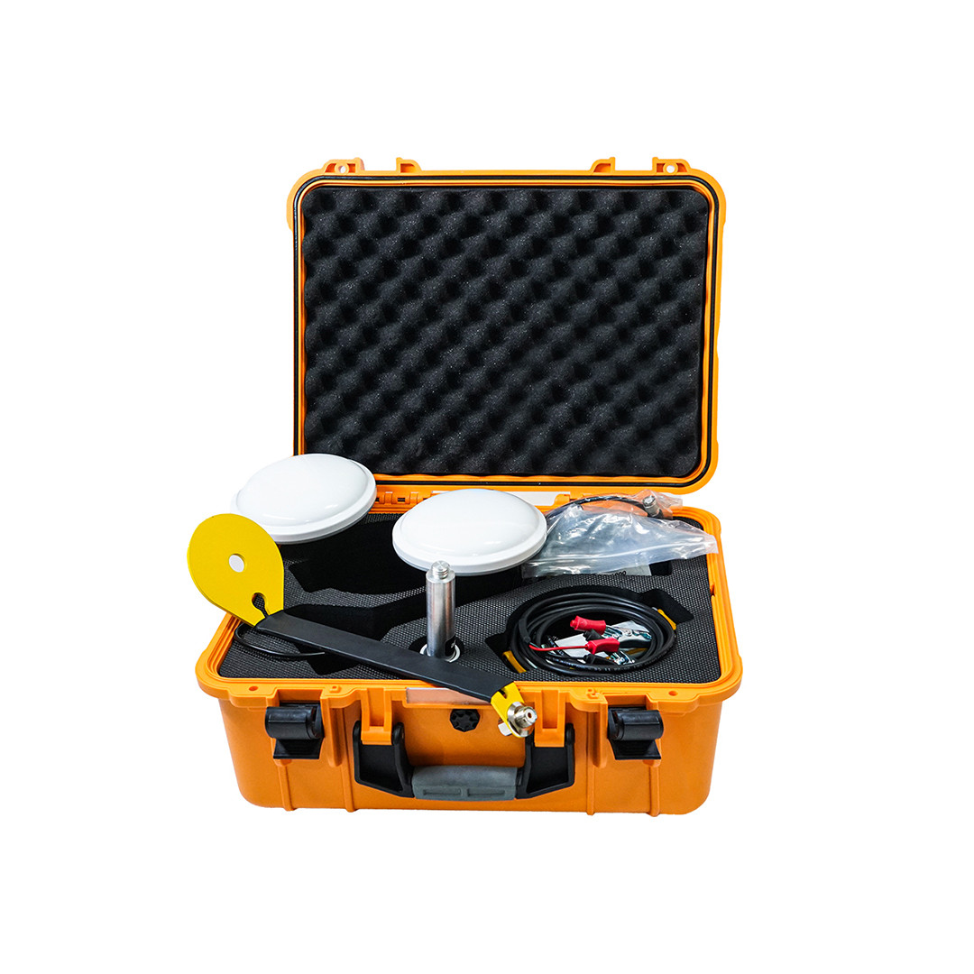
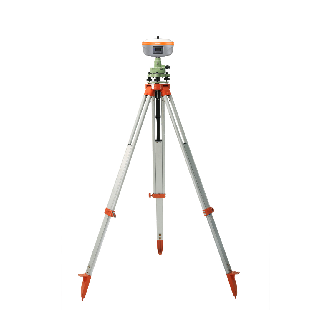
One of the important components of a satellite land leveling system is the reference antenna or base station. This antenna is installed at a fixed position near the field and serves as a reference for the positioning system.
The location of the reference antenna is important because positioning correction data can be provided to the mobile receiver through the base station.
In GNSS and RTK-based systems, the base station provides correction information to the mobile receiver. This information helps achieve a much higher level of positioning accuracy during land leveling operations.
Installing the Mobile Antenna on the Machine
The mobile antenna or GNSS receiver is installed on the agricultural machinery used for the leveling operation. Unlike the fixed reference antenna, the mobile receiver moves together with the machine.
The receiver collects satellite signals and uses correction information from the reference station or another correction source to determine the machine's position and elevation.
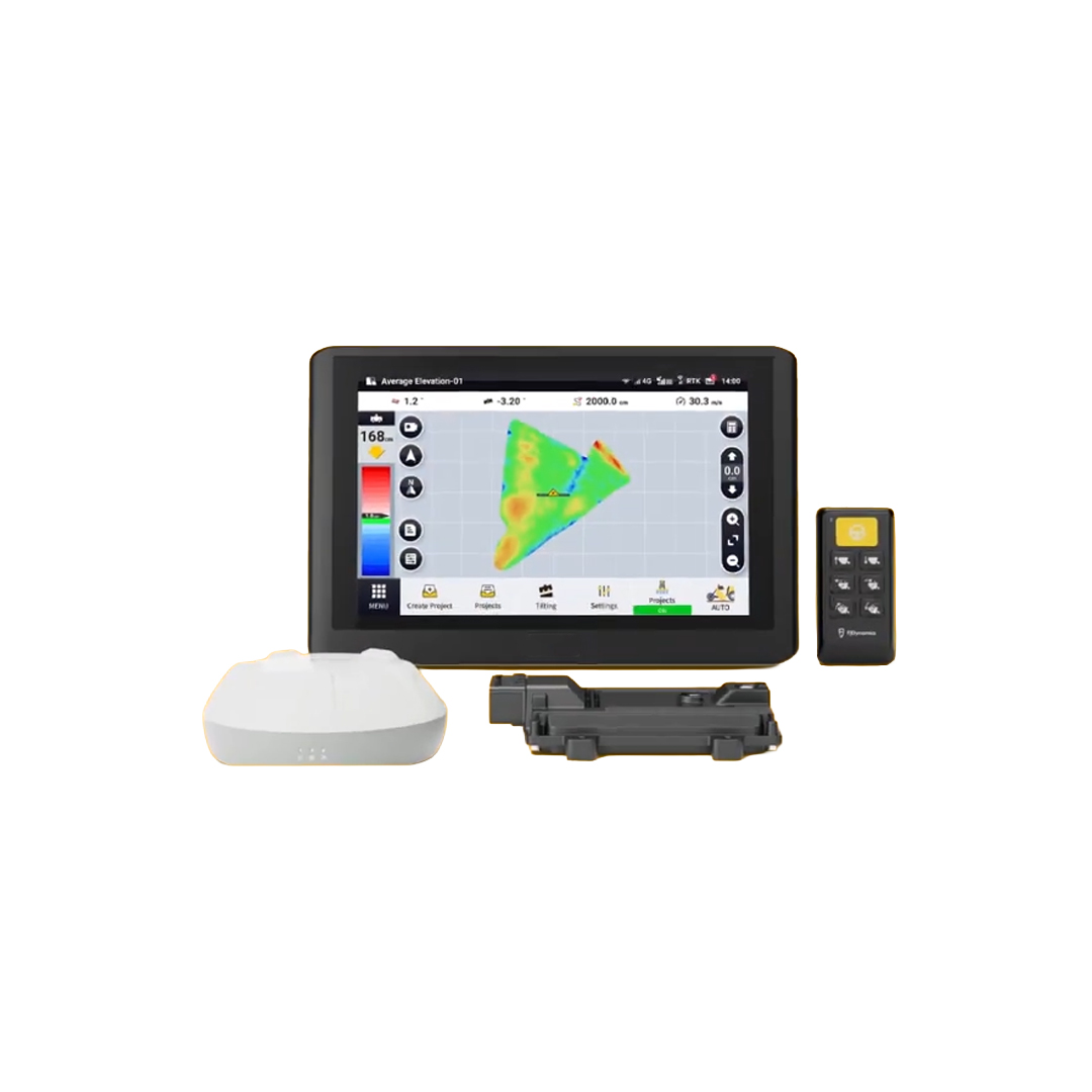
The processed information is then transferred to the control system and display. This allows the operator to monitor the position and elevation of the blade and make more accurate adjustments during the leveling process.
Accurate Positioning
One of the most important stages of satellite land leveling is determining the exact position and elevation of the machine and its blade.
GNSS technology receives signals from satellites and, when combined with RTK correction data, can provide highly accurate positioning information.
The system continuously determines the location and elevation of the equipment and compares it with the target surface.
The information is displayed to the operator, allowing them to understand whether the blade is above or below the required elevation and make the necessary adjustments.
Setting Up and Calibrating the Equipment
After installing the reference antenna, mobile receiver, display, and other components, the system needs to be properly configured and calibrated.
During this stage, important parameters such as the machine dimensions, receiver position, blade position, and other required settings are entered into the system.
Proper calibration is essential because incorrect equipment settings can reduce the accuracy of elevation measurements and affect the final result of the leveling operation.
The communication between different components of the system should also be checked to ensure that positioning data is received, processed, and displayed correctly.
Creating the Target Surface and Elevation Model
Before the main leveling operation begins, the desired surface of the field must be defined.
The target surface can be designed as a flat plane or as a surface with a specific slope, depending on the requirements of the agricultural project.
The system compares the existing elevation of different points on the field with the target elevation. Based on this comparison, it can determine where soil needs to be removed and where additional soil may be required.
This information helps the operator perform soil cutting and filling more efficiently and avoid unnecessary soil movement.
Starting the Land Leveling Operation
After the system has been installed, configured, and prepared, the main leveling operation begins.
The machinery moves across the field while the mobile GNSS receiver continuously determines the machine's position and elevation.
The control system compares the actual elevation with the target elevation and provides the necessary information to the operator.
The operator can then adjust the blade to the appropriate height and remove soil from higher areas while filling lower areas.
In more advanced systems, blade elevation can be controlled automatically or semi-automatically. In this case, the control system uses positioning and elevation data to send commands to the hydraulic system and adjust the blade accordingly.
Repeating the Grading Operation
Achieving a completely uniform surface usually requires more than one pass of the leveling equipment.
After each pass, the field can be evaluated to identify remaining elevation differences. The machine can then return to areas that require additional correction.
Repeating this process gradually reduces elevation differences and brings the field closer to the designed target surface.
The number of passes depends on the initial condition of the land, the accuracy required, the equipment being used, and the design of the target surface.
Checking the Final Result
After completing the leveling operation, the final result should be evaluated to verify the accuracy and quality of the work.
Surveying equipment and accurate positioning systems can be used to measure elevation at different points across the field.
The measured elevations can then be compared with the target surface. If significant differences remain, additional leveling operations can be performed.
Final verification is important because it provides reliable information about whether the desired grading accuracy has been achieved.
Recording the Completed Operations
Recording information about the leveling operation can be extremely useful for future projects.
Information such as the elevation model, machine settings, equipment configuration, amount of soil moved, number of passes, and final results can be saved for future reference.
These records can help operators and farm managers make better decisions during future leveling projects and reduce the time and cost required for planning and execution.
Keeping accurate records also makes it easier to compare different projects and identify improvements that can be made to the leveling process.
Advantages of Using a Satellite Land Leveling System
Satellite land leveling can provide several advantages for modern agricultural operations.
Increased leveling accuracy
Reduced human error
Reduced unnecessary soil movement
Faster completion of leveling operations
Lower operating costs
Suitable for large agricultural fields
Better control of land elevation and slope
Ability to create and use accurate elevation models
Improved water distribution across the field
More uniform land surfaces
Satellite Land Leveling vs. Traditional Land Leveling
Traditional land leveling methods often rely heavily on manual measurements and the experience of the machine operator. Although these methods can be suitable for small projects, they can become time-consuming and less efficient when working on large agricultural fields.
Satellite land leveling, on the other hand, uses GNSS, RTK positioning, elevation models, and machine control systems to provide continuous information about the location and elevation of the equipment.
As a result, the operator can obtain more accurate information about the blade position and its difference from the target elevation. This makes soil cutting and filling more precise and helps reduce unnecessary passes across the field.
Final Thoughts
Satellite land leveling is a modern technology for improving and correcting agricultural land surfaces. By using GNSS receivers, RTK positioning, reference stations, communication systems, and elevation control equipment, the system can significantly improve the accuracy of land leveling operations.
The process begins with evaluating and preparing the field and continues with equipment installation, accurate positioning, calibration, target surface design, and soil cutting and filling. The final stage involves checking the completed surface and making additional corrections if necessary.
When properly installed and operated, a satellite land leveling system can improve the accuracy of agricultural land grading, reduce unnecessary soil movement, save time and operating costs, and help create a more uniform field surface.
For modern agriculture, combining satellite positioning technology with machine control systems provides an effective approach to more accurate land management and improved water use efficiency.
Frequently Asked Questions About Satellite Land Leveling Systems
How does a satellite land leveling system work?
A satellite land leveling system uses GNSS receivers to determine the position and elevation of the machine. In RTK-based systems, correction data is used to improve positioning accuracy. The system compares the actual blade elevation with the target surface and provides guidance to the operator or machine control system.
Does satellite land leveling require an internet connection?
It depends on the type of correction system being used. Some systems receive correction data from a local base station through radio communication, while others may use cellular or internet-based GNSS correction services.
How accurate is satellite land leveling?
The accuracy depends on factors such as the GNSS receiver, correction technology, satellite signal quality, equipment configuration, calibration, and field conditions. RTK-based systems can provide highly accurate positioning suitable for precision land leveling.
Is satellite land leveling suitable for agricultural fields?
Yes. Satellite land leveling is particularly useful for large agricultural fields. It can help improve surface uniformity, water distribution, and the accuracy of soil cutting and filling operations.
What are the main components of a satellite land leveling system?
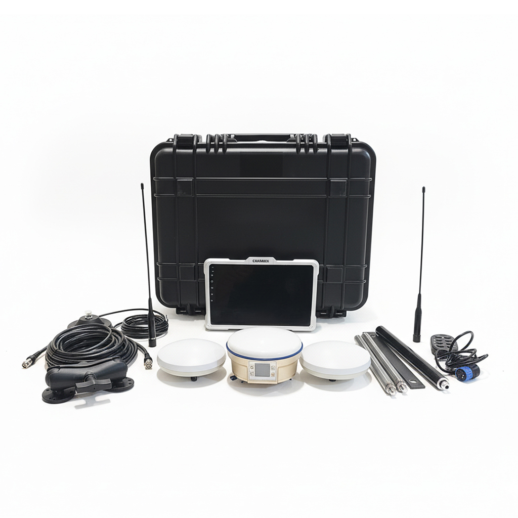
The main components typically include a GNSS receiver, antenna, reference station or correction source, communication equipment, display, machine control system, and hydraulic control components.