What Is Land Leveling? | Methods of Land Leveling
“Land leveling” refers to a set of activities carried out to flatten and grade land with a compatible slope for agricultural fields, landscaping, land development, or construction processes. These operations are designed based on precise engineering studies and implemented using accurate equipment and tools. Land leveling is performed to equalize changes in ground elevation (filling low spots and smoothing high areas) using various tools such as bulldozers, cranes, and more, so that the surface becomes uniform and suitable for the intended purpose.
Pre-Land-Leveling Steps
Before starting land leveling, several preliminary actions must be taken. The most important ones include:
Site Assessment
Before leveling begins, the land must be carefully evaluated in terms of slope, soil type, and moisture content.
Removing Obstacles
Prior to the leveling process, physical obstacles such as rocks, bushes, and trees must be removed.
Land Surveying
Accurate land surveying helps farmers and engineers identify the degree of slope and areas unsuitable for farming.
Planning the Irrigation System
One key step to improve the results of leveling is planning the irrigation system.
Traditional Principles of Land Leveling in the Past
How was land leveling done in the past? Previously, in order to improve water distribution and increase the productivity of agricultural lands, leveling was mostly carried out manually using basic tools. For example, tools such as shovels and manual plows were used. This process was not only very time-consuming but also required a great deal of labor. However, with recent technological advances, modern tools and machinery have replaced traditional methods.
Advantages of Land Leveling Compared with Traditional Methods
Implementing a land leveling plan provides significant advantages over traditional farmlands. By integrating scattered plots, land leveling organizes agricultural lands and makes access routes between farms easier. It also enables mechanization and improves the efficiency of using agricultural equipment, simplifying farming activities. As a result, by increasing land and labor productivity, overall production yields increase.
Improved Drainage
Land leveling, by creating a gentle and appropriate slope away from specific farming areas or structures, helps prevent water accumulation and the damage caused by it.
Better Irrigation Management
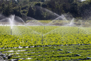
Another advantage of land leveling is improved irrigation and prevention of water loss. By leveling farmland and creating a proper, uniform slope, water can be distributed evenly. With improved irrigation and drainage systems, water reaches all crops uniformly with minimal waste, leading to higher productivity and better product quality.
Adjusting Land Topography
Topography is the study of natural land features and the identification of elevations, hills, valleys, rivers, and man-made features such as buildings and roads, represented on a topographic map. Leveling operations modify the natural topography of the land, resulting in a uniformly sloped, leveled surface. By consolidating scattered plots and smoothing the field for efficient water distribution and irrigation, this process is highly important for increasing agricultural productivity.
Land leveling costs vary depending on the area size, the extent of leveling needed, and the equipment used. Overall, investing in land leveling often leads to positive outcomes through increased agricultural production efficiency and reduced costs and damages in non-agricultural sectors.
Technical Components of Land Leveling
Agricultural land leveling can be done manually or using related machinery and equipment. To preserve the natural soil structure—and therefore maintain good growing conditions for crop roots and keep costs low—heavy earth movement should be avoided.
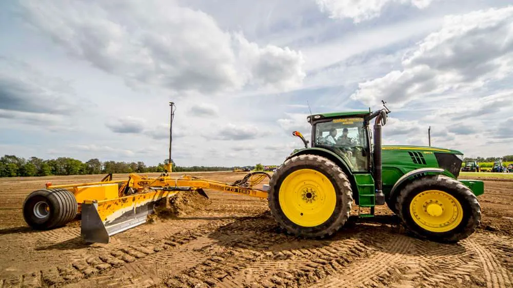
Experienced farmers often level land based on visual assessment—for example, in small fields using shovels, or by using animals and equipment such as plows and rods or scrapers. Other equipment, such as blades and hydraulic levelers mounted on wheels, is also pulled by tractors.
More advanced and complex leveling equipment works with a laser transmitter, a laser sensor or receiver, and a scraper pulled by a tractor. After measuring the surface or slope of the target field and the differences between high and low points, the transmitter is adjusted to create a rotating laser beam that forms a plane of laser light above the field surface. The laser light is used as a leveling reference. The tractor’s hydraulic system controls the moving tractor and scraper, thereby controlling the land grade.
What Are the Methods of Land Leveling?
Land leveling methods vary depending on field size, soil type, and geographic conditions. Common methods include:
Manual Leveling
This method was used in the past with hand tools such as shovels and plows and is suitable for small plots.
Mechanical Leveling
This method uses machinery such as tractors, graders, and bulldozers, offering high speed and accuracy—especially for large areas.
Laser Land Leveling
In laser leveling, laser transmitters and receivers are used to project laser light and determine elevation and slope in different parts of the land. Advantages include high accuracy, high speed, lower cost compared with traditional methods, increased productivity and crop performance, reduced costs to achieve a smooth surface, and reduced dependence on manual labor. The main challenge of laser leveling is the high cost of the equipment.
Satellite Leveling (GPS Leveling)
Satellite leveling, or GPS-based leveling, is one of the most accurate methods for leveling agricultural land. Using GPS, the position of each point on the field can be determined with high precision, and by adjusting the height of the machinery blade, land leveling can be performed more accurately. This method reduces human error and increases leveling accuracy.
In addition to GPS devices, other tools such as GIS (Geographic Information System) are also used. GIS makes it possible to collect comprehensive data about a field’s geographic location and its characteristics—such as soil type, land slope, sunlight intensity, and plant density—and then, using computer software, level the land more precisely.
In this regard, reading the article on how satellite leveling systems work is recommended.
More advanced leveling methods also exist. For example, using leveling robots can improve quality and reduce leveling costs. In this approach, robots equipped with capabilities such as elevation measurement and distance sensing between different points are used for leveling.
Tools Used in Land Leveling
The tools and machinery used in land leveling vary depending on land size and type. Key tools include:
Shovel and plow: In the past, shovels and manual plows were used for leveling.
Tractor: One of the main machines in modern agriculture, used for field operations such as plowing.
Grader: Used to smooth agricultural lands.
Scraper: Used to collect and move soil.
Laser systems: Used to measure and precisely control land elevation.
Factors Affecting Land Leveling Costs
Land leveling costs depend on multiple factors that should be considered before starting the project, including:
Land Size
The larger the land area, the higher the cost, due to the need for larger machinery and more labor.
Soil Type
Soil type significantly affects cost. Hard or rocky soils require specialized equipment and more time.
Land Slope
Steep lands cost more to level because they require more soil movement and more advanced equipment.
Machinery Used
Modern machinery such as graders, scrapers, and laser systems increases costs, but also improves accuracy.
Labor
Labor cost is another key factor.
Geographic Location
Location directly affects leveling costs. Lands in remote areas with difficult access will have higher leveling expenses.
Conclusion Land leveling is a complex and costly process used in many construction projects, road building, and other construction-related projects. To improve quality and reduce costs, various leveling methods are available, including the use of leveling instruments, manual methods, and more advanced approaches such as leveling robots. By using these methods, costs can be reduced and work quality improved.
Rassam GPS (Rassam Lian Machine, formerly Ranjbaran), as a manufacturer and supplier of various agricultural automation machinery and a sales representative for Canamec Canada satellite leveling and laser leveling equipment, has consistently sought to satisfy its customers by providing top-quality agricultural equipment.
If you work in the field of leveling agricultural land and are looking to purchase leveling equipment, you can call 02166593922 to get information about the price of laser leveling cameras and the price of satellite leveling devices.
You can also visit the Rassam GPS store to view different land leveling devices.