Satellite-based land leveling

Offering the best global brands for precise and professional agricultural land leveling

Satellite-based land leveling

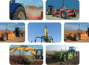
Satellite-based land leveling is a process that uses precise satellite positioning systems (GPS and RTK) to measure the elevation of different points on the ground with millimeter accuracy and levels the land based on a digital elevation map. This technology eliminates the need for string lines or manual surveying and minimizes human error.

Compatible with existing tractors

Fuel saving

Increase in speed

High accuracy up to 2 cm

Rasam Products
FAQ

Yes, Rasam GPS proudly has over 15 years of experience in manufacturing and supplying smart agricultural machinery, and in this field, we are ready to provide the solutions you dear farmers need.

Satellite systems are generally more advanced and accurate than laser systems; however, the dimensions of your land may not be suitable for it. We recommend consulting with our experts to make a better choice.

In addition to exclusively providing you, dear farmers, with the latest and most up-to-date agricultural equipment in the world, Rasam GPS offers superior warranty, damage insurance, and round-the-clock support. In case of any issues or questions, our experts are ready to resolve them in the shortest possible time, both remotely and in person.

The price of laser and satellite leveling equipment varies depending on factors such as the desired brand, type of equipment, and more. To choose the right option for your land and to learn more about the prices, our experts are available every day to answer your questions.

Rasam GPS laser and satellite products come with 12-month insurance policies and 18-month warranty certificates. During the warranty period, any damage or harm caused to the products you have purchased will be repaired by the company.

Latest articles

Request consultation

مشاوره رایگان دریافت کنید

"(ضروری)" indicates required fields

با تکمیل فرم زیر همکاران ما با شما تماس خواهند گرفت