# Applications of Satellite Technology in Agriculture
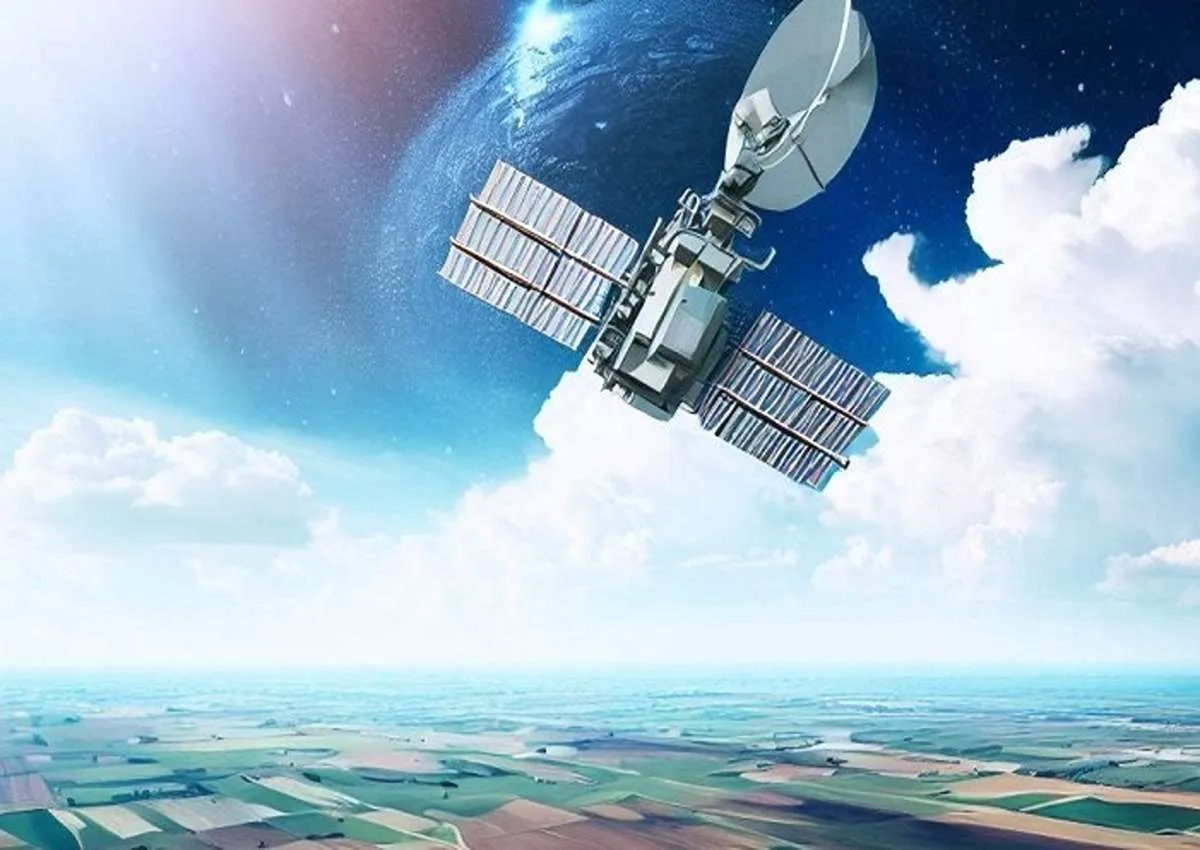
Today, satellite technology is transforming agriculture in remarkable ways. By providing weather forecasting, soil moisture assessment, and high-resolution imagery, satellites deliver valuable information about crop conditions and enable the early detection of potential problems. These capabilities play a crucial role in agricultural decision-making.
Satellite technology supports crop management, soil health analysis, precision agriculture, and weather forecasting. Although the adoption of satellite systems may involve initial investment costs, their contribution to improving productivity, crop performance, and sustainable farming practices is undeniable.
Satellite technology is rapidly revolutionizing modern agriculture. More than just an advancement, it represents a major transformation that enables precise monitoring throughout the farming cycle, simplifies agricultural operations, and significantly improves efficiency. For this reason, embracing these technological changes is becoming increasingly important for agricultural success.
## How Satellite Technology Works in Agriculture
Understanding crop health and soil conditions is essential for predicting weather patterns and planning agricultural activities. Satellite technology provides farmers with valuable insights into their fields, enabling more effective farm management and better decision-making.
By delivering accurate, data-driven information, satellite systems align perfectly with the needs of modern agriculture and have become a key driver of innovation within the agricultural sector.
## Why Satellite Technology Is Ideal for Agriculture
One of the primary reasons satellite technology is so valuable in agriculture is the accuracy of the data it provides.
Satellite systems offer precise measurements and comprehensive field analysis, giving farmers a broader perspective of their agricultural operations and helping them improve productivity.
In addition, satellite data collection occurs without disrupting farming activities. Farmers can continue their normal operations while receiving critical information, eliminating the need for significant changes to existing workflows.
## Applications of Satellite Technology in Agriculture
Satellite technology offers numerous practical applications across the agricultural industry.
### Crop Management
Satellite imagery provides high-resolution visual data that allows farmers to identify crop stress, pest infestations, drought conditions, and nutrient deficiencies at an early stage.
Early detection enables farmers to take corrective action quickly, reducing crop losses and improving yields.
### Soil Health Analysis
Satellite technology provides valuable information about soil temperature, composition, and moisture levels. These insights help farmers assess soil health, optimize irrigation systems, implement effective soil improvement programs, and enhance overall soil quality.
### Precision Agriculture
Satellite data delivers detailed information regarding crop performance and soil variability, making precision agriculture possible.
Farmers can use this information to develop targeted farming strategies, optimize input usage, improve resource efficiency, and reduce environmental impacts while increasing productivity.
### Weather Forecasting
Weather forecasting is one of the most important applications of satellite technology in agriculture.
Satellite systems help farmers prepare for adverse weather conditions such as:
* Heavy rainfall
* Frost
* Strong winds
* Storms
* Drought conditions
Accurate forecasts allow farmers to make informed decisions regarding planting schedules, harvesting operations, and risk management strategies.
### Satellite Land Leveling
Satellite-guided land leveling is one of the most efficient applications of GNSS technology in modern agriculture.
Compared with traditional laser leveling systems, satellite leveling offers significantly greater operational range—up to approximately 5 kilometers—without requiring operators to remain close to a fixed base station.
Satellite-guided systems can be installed on a wide variety of agricultural machinery, providing flexibility and efficiency across different farming operations.
By utilizing precise positioning data, satellite land leveling improves:
* Water distribution
* Field uniformity
* Operational efficiency
* Fuel consumption
* Resource management
## Additional Benefits of Satellite Technology
Satellite technology contributes to agriculture in several important ways:
* Increased productivity and crop performance
* Improved farm management and production planning
* Better monitoring of natural disasters and environmental risks
* Reduction of agricultural waste
* More efficient use of water and soil resources
* Monitoring crop growth stages
* Prediction of crop development cycles
One of the most valuable advantages of satellite technology is the ability to generate highly accurate agricultural maps.
These maps are created using Geographic Information Systems (GIS), which integrate spatial data and satellite imagery to provide detailed visual representations of field conditions and crop distribution.
## Challenges and Disadvantages of Satellite Technology in Agriculture
Despite its many advantages, satellite technology also presents several challenges.
### High Initial Investment
The cost of implementing satellite-based systems can be significant, especially for small farms or farmers who are new to precision agriculture technologies.
### Data Collection Delays
Accessing and processing satellite data may sometimes require considerable time, which can affect the speed of decision-making in certain situations.
### Data Privacy Concerns
The collection, storage, and sharing of agricultural data may raise concerns regarding data ownership and privacy, particularly when sensitive farm information is involved.
## How Farmers Can Adopt Satellite Technology Successfully
Farmers can maximize the benefits of satellite technology by following several key steps:
### 1. Participate in Training Programs
Attending workshops, webinars, and educational programs helps farmers understand satellite technology and its practical applications.
### 2. Identify Agricultural Challenges
Farmers should evaluate their specific operational challenges and select satellite solutions that address their most critical needs.
### 3. Define Clear Objectives
Establishing goals such as improving resource efficiency, increasing productivity, or reducing risk helps ensure successful technology implementation.
### 4. Start with Basic Applications
Beginning with simple applications such as crop monitoring allows farmers to evaluate the technology and gain confidence before expanding its use.
### 5. Recognize Technology as a Support Tool
Satellite technology is designed to support farmers—not replace them. These systems help producers make better decisions, improve efficiency, and implement more sustainable farming practices.
## Conclusion
Agriculture is increasingly becoming a technology-driven industry, and satellite technology is one of the most influential innovations shaping its future.
Rather than being just another agricultural tool, satellite systems represent a transformative shift in the way farming operations are managed. By optimizing agricultural processes, improving resource utilization, and enhancing productivity, satellite technology is helping create a more sustainable and efficient future for agriculture.
As the agricultural sector continues to evolve, integrating satellite technology into everyday farming practices will enable farmers to remain at the forefront of innovation and competitiveness.
Embracing this technological transformation today can open the door to greater productivity, improved sustainability, and long-term agricultural success.
Rassam GPS (formerly Rangbaran, now operating as Rassam Lian Machine) is a manufacturer and supplier of agricultural automation systems and advanced land leveling technologies. As an authorized provider of satellite-guided and laser-guided land leveling equipment from Canamac Canada, Rassam GPS is committed to delivering high-quality agricultural solutions that help farmers increase efficiency, improve productivity, and achieve sustainable growth.